
Simplicity

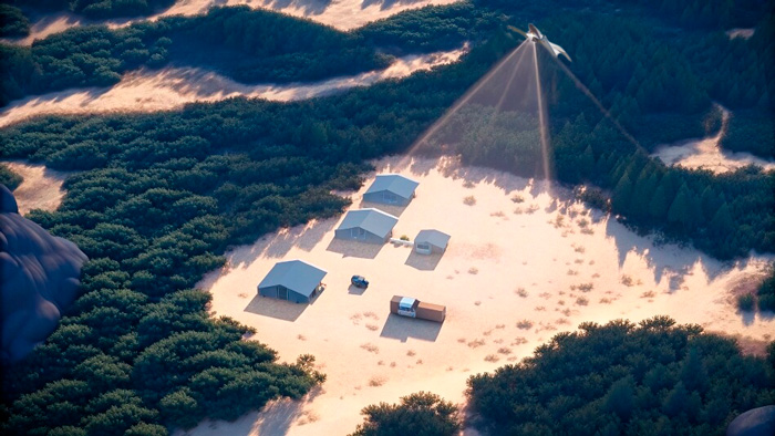
Autonomous AI-driven UAVs for BVLOS operations
This unlocks limitless possibilities across various applications
This unlocks limitless possibilities across various applications
Search & rescue center

.jpg)


Fully autonomous BVLOS UAV, with the operator coordinating. FIXAR AI analyzes data and makes real-time decisions.

Redefining industries with
AI-powered UAVs
Public safety

Redefining industries with
AI-powered UAVs
Public safety

Monitor large public gatherings, protests, or events to identify potential disturbances and manage crowd behavior in real time.

Deploy thermal imaging and night vision payloads to locate missing persons in remote or hard-to-reach areas.

Assist in delivering critical supplies, such as medicine or food, to disaster-stricken or inaccessible locations.

Utilize UAVs as mobile communication relays in areas with limited infrastructure or during large-scale emergencies.

Assess damage from natural disasters like floods, earthquakes, or wildfires, and identify survivors in need of rescue.
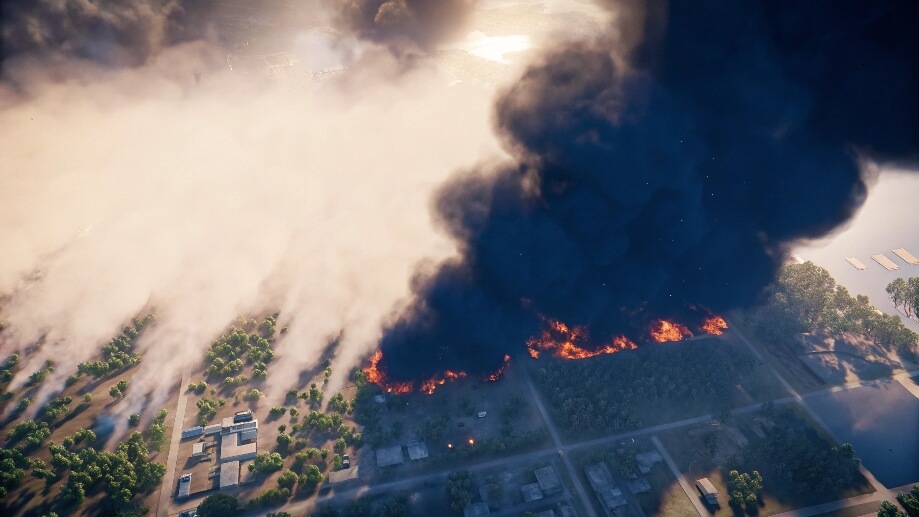
Deliver real-time aerial intelligence on critical situations such as fires, hazardous material spills, or structural collapses.
Law enforcement

Detect unauthorized crossings and smuggling operations by monitoring vast border areas in real time.
Enhance road safety through live traffic monitoring, automated violation detection, and rapid response to accidents.

Provide live aerial video feeds during high-risk missions like hostage rescues while enabling detailed reconnaissance of buildings and areas before entry.

Capture high-resolution aerial imagery and 3D scene mapping for crime scene analysis and detailed forensic reconstructions.
.jpg)
Maintain continuous surveillance of suspects across various terrains while minimizing officer exposure to risks, using AI-powered object tracking for dynamic target following.
Identify and track illegal activities such as fishing, poaching, and drug cultivation in remote areas.
Industrial and commercial

Ensure fast and reliable transport of medical supplies, vaccines, and other essential goods to remote locations or during emergency situations.

Perform high-precision aerial laser scanning to map terrain and generate accurate 3D models, even in remote, densely forested, or inaccessible areas.

Capture and process high-resolution aerial images to generate detailed geospatial data, topographic maps, and 3D terrain models for construction, urban planning, and land management.

Optimize crop management and forest valuation through aerial monitoring, detecting plant health variations, pest infestations, and soil conditions.

Conduct automated inspections of critical infrastructure such as bridges, power lines, pipelines, and industrial facilities, reducing maintenance costs and improving safety.

Monitor and track animal populations, migration patterns, and habitat changes in both terrestrial and aquatic environments without disturbing ecosystems.
Redefining industries with
AI-powered UAVs
Public safety
Law enforcement
.jpg)
Industrial and сommercial

One technology, three solutions
Autonomous operations
High payload and versatility
Autonomous operations
High-efficiency and long-endurance
Autonomous operations
Redefining efficiency
FIXAR 025
High payload and versatility
Autonomous operations
FIXAR 007 LE
High-efficiency and long-endurance
Autonomous operations
FIXAR 007 NG
Redefining efficiency
Autonomous operations
Choose your FIXAR
adapt your mission
Technological advancement
.jpg)

.jpg)
.jpg)
%20(1)%201.jpg)
.jpg)
.jpg)
Heading placeholder
.jpg)


%20(1).jpg)


